Lisbon Tagus Bay by Bicycle: a Pizza Quest
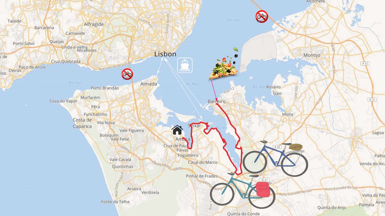
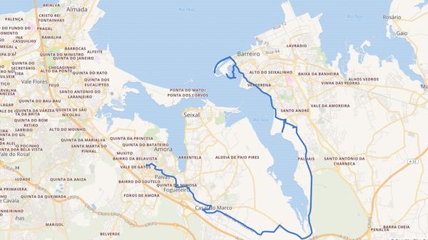
Lisbon's Tagus Bay has many side arms and is and not easy to cross. Our neighbor's pizzeria is 5 km away as the crow flies, by bicycle it was a nice tour of 25 km along the water: from Amora via Seixal to Barreiro.
By bicycle across the Tagus Bay
No matter on which side of the Tagus Bay: cycling is a challenge both in Lisbon and on its South Bay, the "Margem Sul". The cycling infrastructure is still in its infancy. As if that weren't enough, crossing the bay isn't easy either. Both bridges are closed to cyclists and pedestrians! If you are a resident: here is the petition for a bicycle lane over the bridge of 25 de Abril.
There are ferrys to Lisbon in the area where we cycle: in Almada, Seixal and Barreiro. On the ferries we can take the bike. However, there is no ferry connection between these places on the south side of the bay. There are also no bridges across these side arms of the Tagus Bay, not now and not in the near future.
So, we either have to carry an inflatable SUP or bike around the whole bay. The latter is a good option, because the bay offers spectacular views and the path is quite ridable, even without a mountain bike. Check out our video of our bike tour to our neighbor's pizzeria!
Amora – Seixal: the first bay
From our home in Amora, we drive a short distance through town to the bay. There is a bike path that goes around the bay to Seixal. At low tide, this side arm of the Tagus Bay is completely without water. A small stream, the Rio Judeu, flows into the bay, but hardly carries any water.
In Seixal we reach the banks of the main bay of the Tagus. It is huge and carries water even at low tide.
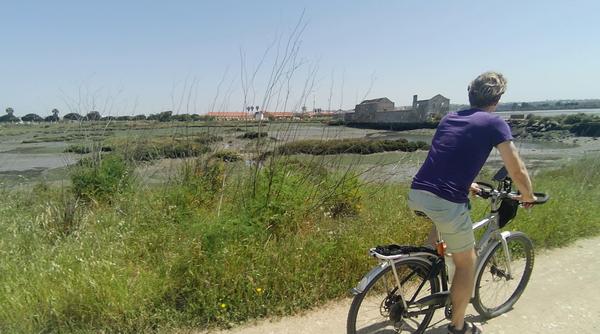
There used to be countless tide mills along this bay. The water was collected in a reservoir at high tide and used to turn the millstones at low tide. In the photo you can see one of the many ruins of such a tide mill.
Seixal – Barreiro: the second bay
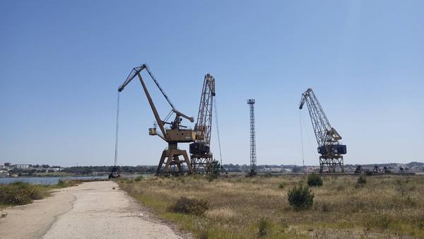
On the Seixal side of the next side arm, we can also bike directly along the water. An industrial area lies between the water and the city. The hiking trail, on which we ride our touring bikes, meanders along sand hills, loading cranes and old rails. Pure industrial romance!
Sometimes the route is a bit adventurous, goes through a cut-open fence, briefly downhill and of course through sand from time to time. Menno just pedals across every one of those little challenges, while I have to push here and there because I don't have the necessary momentum over the spot (see video minute 5 and 5:50 😬)
At the end of this side arm, the Coina River flows into the bay. And we have to get onto the road, the N10, where cycling really is no fun. Luckily only for a short time, then we turn towards Barreiro. Unfortunately, we cannot bike along the water here. First there is swamp and then a military compound. So country road and then through the city. The traffic is OK, we arrive relaxed at our neighbor's pizzeria.
The Tagus Bay in front of Barreiro is very wide, Lisbon seems far away. A fresh wind is blowing. Over pedestrian bridges, you get across the many side arms of the bay to a folksy city beach. On the way back we manage to cycle along the water for about 5 km, then we have to get on the road and take the shortest way home.
Following the water line of the Tagus Bay is fun! Nevertheless, we would love to see better and safer infrastructure for bicycles and pedestrians. On this website we share our routes and experiences, so you don't have to wait for better times to come, but can start your cycling adventure right now.
Get on your bike and share the most beautiful, safest, shortest, or longest and most practical bike routes with others. Talk about holidays by bicycle. Give someone a bike or a bike day! Just don't give up until everyone's riding by bicycle. Because cycling makes you happy.
The maps in this article were created using MapHub using the map National Geographic, Esri, DeLorme, HERE, UNEP-WCMC, USGS, NASA, ESA, METI, NRCAN, GEBCO, NOAA, iPC.


